India has recently made a significant leap in weather forecasting technology with the launch of the Bharat Forecast System (BFS). As the world’s most precise weather prediction model, this cutting-edge system offers high-resolution forecasts that can revolutionize agriculture, disaster preparedness, and climate monitoring across the nation.
In this article, you’ll discover what the Bharat Forecast System is, how it works, its key features, benefits, and why it matters now more than ever.
What Is the Bharat Forecast System?
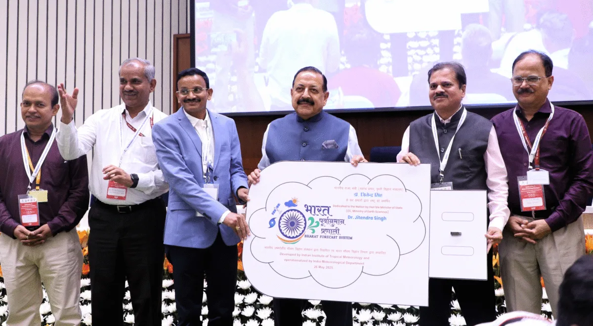
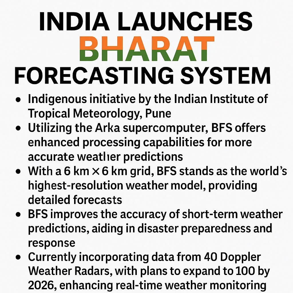
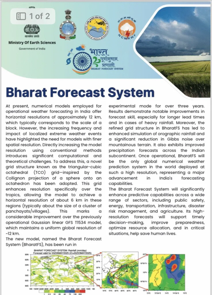
The Bharat Forecast System is a next-generation global weather forecasting model, fully developed in India by the Indian Institute of Tropical Meteorology (IITM), Pune. Unlike previous models that relied on imported technology, this one is completely indigenous. Therefore, it marks a crucial shift toward self-reliance in meteorological science.
Quick Facts:
- Launched: May 26, 2025
- Developed by: IITM, Pune
- Under: Ministry of Earth Sciences (MoES)
- Forecasting Resolution: 6 km (highest globally)
- Computational Power: Supercomputer ‘Arka’ (11.7 petaflops)
- Operational Authority: India Meteorological Department (IMD)
Why Does the Bharat Forecast System Matter?
Every year, India faces a multitude of weather-related challenges such as cyclones, floods, and heatwaves. Consequently, there is a growing demand for faster, more localized, and more accurate weather forecasting tools. The Bharat Forecast System directly addresses these needs.
In fact, the BFS is the first Indian weather model with a 6-kilometer resolution, providing a much sharper and more detailed picture of weather patterns across the country. As a result, predictions become more reliable and actionable.
How Does the Bharat Forecast System Work?
Unlike traditional systems, the BFS operates using a high-performance numerical weather prediction (NWP) model. It collects data from various sources, including:
- Satellites
- Weather balloons
- Ground-based sensors
- Ocean buoys
- Doppler radar networks
After gathering this data, it is processed using ‘Arka’, one of India’s most powerful supercomputers. With 11.7 petaflops of computing power, Arka enables the BFS to run simulations faster and with greater accuracy than ever before.
Moreover, the system uses Artificial Intelligence (AI) to improve forecast accuracy through real-time adjustments and bias corrections.
Key Features of the Bharat Forecast System
To understand why BFS is groundbreaking, let’s explore its core features:
1. Ultra-High Resolution (6 km)
Previously, global models had resolutions of 12 to 25 km. By contrast, BFS provides a 6 km resolution, which allows for hyper-local predictions, especially beneficial in diverse terrains like the Himalayas or coastal areas.
2. Fully Indigenous Technology
Since the model is designed and implemented in India, it is customized to the country’s unique climatic zones. Furthermore, it reduces dependence on foreign models.
3. AI-Enhanced Forecasting
In addition to traditional simulation methods, BFS employs AI and machine learning to fine-tune results. This leads to quicker, smarter, and more adaptive forecasting.
4. Integrated Global and Local Modeling
BFS not only forecasts weather across India but also contributes to global weather modeling, offering a broader perspective.
How Will Bharat Forecast System Help India?
The benefits of BFS are far-reaching and touch multiple sectors. Here’s how:
Agriculture
Farmers often suffer due to unpredictable weather. However, BFS can provide highly localized forecasts that help in crop planning, irrigation management, and pest control. As a result, it can reduce losses and boost productivity.
Disaster Management
With more precise predictions of cyclones, floods, and heatwaves, authorities can issue timely warnings. Consequently, communities can prepare in advance and avoid major losses.
Urban Planning
Urban centers face challenges like heatwaves, waterlogging, and air pollution. Fortunately, BFS helps planners design smarter drainage systems and implement climate-resilient infrastructure.
Fisheries and Coastal Safety
Accurate forecasts of sea conditions benefit fishing communities and maritime industries. This ensures safer navigation and better planning for marine activities.
Aviation and Transportation
The aviation industry relies heavily on real-time weather updates. With BFS, airlines can optimize flight paths and reduce weather-related delays.
Bharat Forecast System vs. Previous Weather Models
Here’s a side-by-side comparison that highlights the superiority of BFS:
| Feature | Older Models (e.g., NCMRWF, GFS) | Bharat Forecast System (BFS) |
|---|---|---|
| Resolution | 12–25 km | 6 km |
| Development Origin | Foreign | Indian |
| Computing Power | Limited | 11.7 petaflops |
| AI Integration | Low | High |
| Forecast Speed | Slower | Real-time |
| Local Accuracy | Moderate | High |
Clearly, BFS brings in a major technological upgrade.
Improving Monsoon Forecasts with BFS
India’s economy is deeply tied to the monsoon season. Fortunately, BFS is capable of forecasting the onset, duration, and withdrawal of the monsoon with far greater accuracy. Not only does this support water resource management, but it also assists in power generation, agriculture, and food security.
Moreover, BFS improves prediction of extreme events such as:
- Cloudbursts
- Flash floods
- Prolonged dry spells
This leads to better planning and reduced damage.
What’s Next for the Bharat Forecast System?
Looking ahead, the government plans to:
- Upgrade BFS to 3 km resolution
- Expand real-time climate monitoring
- Use BFS data in public apps like Mausam and Damini
- Support policy decisions for climate resilience
Furthermore, BFS will be integrated into disaster management dashboards, city planning tools, and climate insurance schemes.
Final Thoughts
The Bharat Forecast System is a landmark achievement in India’s scientific and technological landscape. By providing fast, high-resolution, and reliable forecasts, it will:
- Save lives during natural disasters
- Empower farmers with timely updates
- Enhance planning across industries
- Make India a leader in climate forecasting
In conclusion, the BFS is not just a forecasting tool—it’s a national asset.

